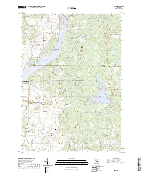
2023 Map of Hope
USGS Topo · Published 2023About this map
The Tittabawassee River carves through this Midland County landscape, defining the local geography as it flows past Lockwood Beach. This central Michigan area is characterized by an extensive system of agricultural and civil engineering works, including the McCoy Drain, Schoolhouse Drain, and Pony Drain, which manage the low-lying terrain near the Gladwin Co and Midland Co boundary. The settlement of Hope serves as a local anchor, supported by historical sites like Hope Cem and the nearby New Hope Cem. To the north, the community of Billings sits near the Billings Cem, surrounded by a grid of rural roads and drainage ways like Payne Creek. A significant hydrological feature, the Kawkawlin Creek Flooding, illustrates the complex water management required in this region, where numerous small tributaries like Denion Creek and Hess Drain converge toward the river basin.
Find a feature on this map
107 named features on this map. Tap any name to fly to it.
Don’t see what you’re looking for? This feature index may not catch every label — zoom into the map to look around manually.
Map Details
Editions of this 2023 Hope Map
This is the sole edition of this map. No revisions or reprints were ever made.
Other maps of this area

1934 · Sanford
USGS Topo · 1:62,500

1936 · Sanford
USGS Topo · 1:62,500

1954 · Midland
USGS Topo · 1:250,000

1958 · Midland
USGS Topo · 1:250,000

1959 · Midland
USGS Topo · 1:250,000

1962 · Midland North
USGS Topo · 1:24,000

1966 · Midland
USGS Topo · 1:250,000

1969 · Gladwin
USGS Topo · 1:24,000
1969 · Hope
USGS Topo · 1:24,000
1969 · Bentley
USGS Topo · 1:24,000