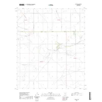
2023 Map of Hope NE
USGS Topo · Published 2023About this map
North Cottonwood Creek and its southern counterpart define the drainage patterns of this high plains landscape at the border of Chaves and Eddy counties. The terrain is characterized by subtle elevation shifts and winding arroyos like South Cottonwood Creek, which converge as they move eastward across the desert floor. This area is crisscrossed by a grid of rural roads, many bearing descriptive names such as W Walnut Draw Rd, White Tail Rd, and Ogalalla Rd, indicating the grazing and ranching history of the region. The map captures the intersection of early land divisions and modern infrastructure, including the junction of Pearson Rd and Raleigh Rd near the county line. The presence of Indianapolis Rd and W Bittersweet Rd suggests a network of local connectors serving scattered homesteads and livestock operations in this corner of New Mexico.
Find a feature on this map
28 named features on this map. Tap any name to fly to it.
Don’t see what you’re looking for? This feature index may not catch every label — zoom into the map to look around manually.
Map Details
Editions of this 2023 Hope NE Map
This is the sole edition of this map. No revisions or reprints were ever made.
Other maps of this area

1952 · Hagerman SW
USGS Topo · 1:24,000

1953 · Espuela
USGS Topo · 1:24,000

1954 · Carlsbad
USGS Topo · 1:250,000

1955 · Artesia
USGS Topo · 1:24,000

1955 · Hope NW
USGS Topo · 1:24,000

1955 · Hackberry Ranch
USGS Topo · 1:24,000

1955 · Kincaid Ranch
USGS Topo · 1:24,000

1955 · Hope NE
USGS Topo · 1:24,000

1955 · Hope
USGS Topo · 1:24,000

1955 · Roswell
USGS Topo · 1:250,000