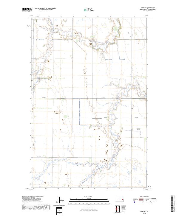
2024 Map of Hope NE
USGS Topo · Published 2024About this map
The Middle Branch Goose River and South Branch Goose River meander through this rural section of Steele County, defining a landscape of low-lying wetlands and prairie drainages. The region's agricultural and local-history roots are anchored by sites such as the Perry Lutheran Cem and the Erickson Airport located near CO Hwy 10. Drainage systems like the Primrose Drain illustrate the long-term modification of the land to support farming in this North Dakota interior. A simple grid of county routes, including CO Hwy 8 and CO Hwy 11, connects the dispersed farmsteads and sections, preserving a pattern of settlement that has remained largely unchanged for decades.
Find a feature on this map
16 named features on this map. Tap any name to fly to it.
Don’t see what you’re looking for? This feature index may not catch every label — zoom into the map to look around manually.
Map Details
Editions of this 2024 Hope NE Map
This is the sole edition of this map. No revisions or reprints were ever made.
Other maps of this area

1952 · Grand Forks
USGS Topo · 1:250,000

1956 · Grand Forks
USGS Topo · 1:250,000

1966 · Grand Forks
USGS Topo · 1:250,000

1966 · Galesburg
USGS Topo · 1:24,000

1966 · Hope SE
USGS Topo · 1:24,000

1968 · Hope NE
USGS Topo · 1:24,000
1968 · Galesburg
USGS Topo · 1:24,000

1968 · Sherbrooke
USGS Topo · 1:24,000
1968 · Galesburg NW
USGS Topo · 1:24,000
1968 · Hope
USGS Topo · 1:24,000
Featured Places
- Sherbrooke Township, ND
- Edendale Township, ND
- Enger Township, ND
- Golden Lake Township, ND
- Primrose Township, ND