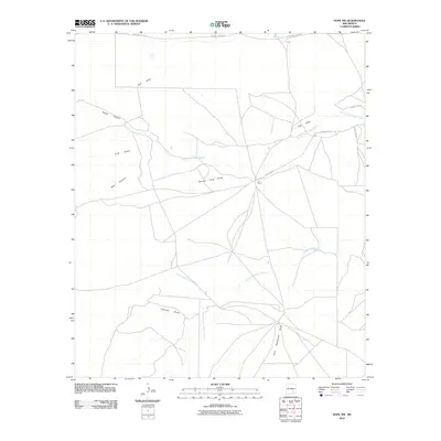
2010 Map of Hope NW
USGS Topo · Published 2010About this map
J X Ranch serves as a central landmark in this arid portion of Chaves County, where the landscape is defined by an intricate network of drainage draws and seasonal watercourses. The drainage patterns of the Pecos River basin are clearly visible, with North Cottonwood Creek and South Cottonwood Creek carving paths through the terrain. These ephemeral waterways are joined by specifically named features such as George Long Draw and Paris Dainwood Draw, indicating a long history of local land naming by ranching families and early settlers. The road network, including County Rd 129 and W Walnut Draw Rd, follows the natural contours of the land, connecting remote outposts through a series of canyons like Goaty Canyon and Well Canyon. This survey provides a precise view of the geographic isolation and the essential water-dependent naming conventions of the New Mexico high plains.
Find a feature on this map
16 named features on this map. Tap any name to fly to it.
Don’t see what you’re looking for? This feature index may not catch every label — zoom into the map to look around manually.
Map Details
Editions of this 2010 Hope NW Map
This is the sole edition of this map. No revisions or reprints were ever made.
Other maps of this area

1954 · Carlsbad
USGS Topo · 1:250,000

1955 · Hope NW
USGS Topo · 1:24,000

1955 · Hackberry Ranch
USGS Topo · 1:24,000

1955 · Kincaid Ranch
USGS Topo · 1:24,000

1955 · Hope NE
USGS Topo · 1:24,000

1955 · Hope
USGS Topo · 1:24,000

1955 · Roswell
USGS Topo · 1:250,000

1956 · Hope
USGS Topo · 1:24,000

1956 · Hope SE
USGS Topo · 1:24,000

1958 · Carlsbad
USGS Topo · 1:250,000