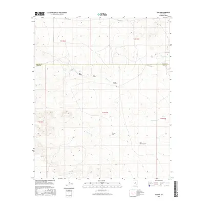
2017 Map of Hope NW
USGS Topo · Published 2017About this map
N Cottonwood Cr and S Cottonwood Cr define the drainage patterns across this high desert landscape on the border of Chaves and Eddy counties. The terrain is deeply etched by numerous draws and canyons, suggesting a watershed characterized by ephemeral flows and sudden runoff. Notable landforms such as Goaty Canyon and Well Canyon provide landmarks in a territory otherwise marked by wide-open spaces and section lines.
Find a feature on this map
20 named features on this map. Tap any name to fly to it.
Don’t see what you’re looking for? This feature index may not catch every label — zoom into the map to look around manually.
Map Details
Editions of this 2017 Hope NW Map
This is the sole edition of this map. No revisions or reprints were ever made.
Other maps of this area

1954 · Carlsbad
USGS Topo · 1:250,000

1955 · Hope NW
USGS Topo · 1:24,000

1955 · Hackberry Ranch
USGS Topo · 1:24,000

1955 · Kincaid Ranch
USGS Topo · 1:24,000

1955 · Hope NE
USGS Topo · 1:24,000

1955 · Hope
USGS Topo · 1:24,000

1955 · Roswell
USGS Topo · 1:250,000

1956 · Hope
USGS Topo · 1:24,000

1956 · Hope SE
USGS Topo · 1:24,000

1958 · Carlsbad
USGS Topo · 1:250,000