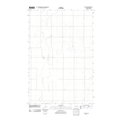
2011 Map of Hope SE
USGS Topo · Published 2011About this map
The South Branch Goose River meanders through the central and western sections of this landscape in Steele County, North Dakota. This 2011 survey by the U.S. Geological Survey shows a rural terrain defined by a precise section-line road network, including thoroughfares such as County Hwy-8 and County Hwy-10. In the southeastern corner, the Elm River appears, contributing to the drainage pattern of this agricultural region. The map reflects the enduring township-and-range system of the northern plains, where small prairie wetlands and depressions are scattered between the established transit routes of County Hwy-9 and County Hwy-1.
Find a feature on this map
7 named features on this map. Tap any name to fly to it.
Don’t see what you’re looking for? This feature index may not catch every label — zoom into the map to look around manually.
Map Details
Editions of this 2011 Hope SE Map
This is the sole edition of this map. No revisions or reprints were ever made.
Other maps of this area

1952 · Grand Forks
USGS Topo · 1:250,000

1956 · Grand Forks
USGS Topo · 1:250,000

1966 · Grand Forks
USGS Topo · 1:250,000

1966 · Galesburg
USGS Topo · 1:24,000

1966 · Hope SE
USGS Topo · 1:24,000

1967 · Ayr NW
USGS Topo · 1:24,000

1967 · Page
USGS Topo · 1:24,000

1967 · Colgate
USGS Topo · 1:24,000

1968 · Hope NE
USGS Topo · 1:24,000
1968 · Galesburg
USGS Topo · 1:24,000