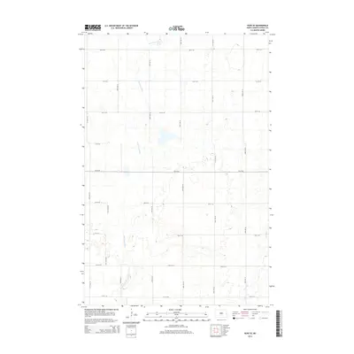
2014 Map of Hope SE
USGS Topo · Published 2014About this map
The South Branch Goose River meanders across this rural landscape in southeastern Steele County, reflecting the glacial hydrology of the Red River Valley region. This map shows a precision-engineered grid of section-line roads, including 3rd St SE and 140th Ave SE, which define the agricultural character of the territory. The topography is dominated by numerous small wetlands and depressions typical of the prairie pothole region, particularly surrounding the upper reaches of the S Br Goose River. To the southeast, the Elm River drains toward the Red River of the North, marking a subtle divide in the local drainage patterns. This survey provides a clear view of the rural infrastructure and natural watercourses before modern developments altered the local drainage basins.
Find a feature on this map
19 named features on this map. Tap any name to fly to it.
Don’t see what you’re looking for? This feature index may not catch every label — zoom into the map to look around manually.
Map Details
Editions of this 2014 Hope SE Map
This is the sole edition of this map. No revisions or reprints were ever made.
Other maps of this area

1952 · Grand Forks
USGS Topo · 1:250,000

1956 · Grand Forks
USGS Topo · 1:250,000

1966 · Grand Forks
USGS Topo · 1:250,000

1966 · Galesburg
USGS Topo · 1:24,000

1966 · Hope SE
USGS Topo · 1:24,000

1967 · Ayr NW
USGS Topo · 1:24,000

1967 · Page
USGS Topo · 1:24,000

1967 · Colgate
USGS Topo · 1:24,000

1968 · Hope NE
USGS Topo · 1:24,000
1968 · Galesburg
USGS Topo · 1:24,000