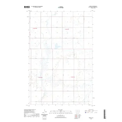
2020 Map of Hope SE
USGS Topo · Published 2020About this map
Fullers Lake sits at the heart of this Steele County landscape, a central wetland feature in a region defined by its complex glacial hydrology. The prairie terrain is deeply influenced by the meandering courses of the S Br Goose River, also labeled here as the South Branch Goose River, and the headwaters of the Elm River in the southeast. This 2020 survey illustrates the rigid Public Land Survey System grid that dictates the movement of modern travelers along routes like Co Hwy 8 and Co Hwy 1. The map reveals how the natural flow of these northern rivers intersects with the straight lines of section roads, creating a checkerboard of agricultural parcels and scattered prairie potholes characteristic of the Red River Valley’s western fringes.
Find a feature on this map
17 named features on this map. Tap any name to fly to it.
Don’t see what you’re looking for? This feature index may not catch every label — zoom into the map to look around manually.
Map Details
Editions of this 2020 Hope SE Map
This is the sole edition of this map. No revisions or reprints were ever made.
Other maps of this area

1952 · Grand Forks
USGS Topo · 1:250,000

1956 · Grand Forks
USGS Topo · 1:250,000

1966 · Grand Forks
USGS Topo · 1:250,000

1966 · Galesburg
USGS Topo · 1:24,000

1966 · Hope SE
USGS Topo · 1:24,000

1967 · Ayr NW
USGS Topo · 1:24,000

1967 · Page
USGS Topo · 1:24,000

1967 · Colgate
USGS Topo · 1:24,000

1968 · Hope NE
USGS Topo · 1:24,000
1968 · Galesburg
USGS Topo · 1:24,000