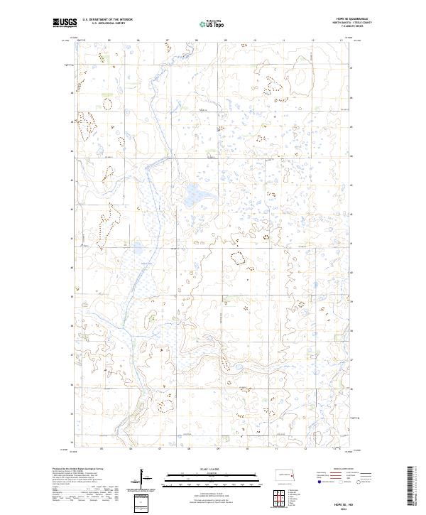
2024 Map of Hope SE
USGS Topo · Published 2024About this map
The South Branch Goose River meanders across this prairie landscape, defining the character of a region heavily managed for conservation. At its heart lies the Steele County Waterfowl Production Area, a significant wetland complex that includes Fullers Lake. This landscape is partitioned by a precise grid of county roads, such as Co Hwy 8 and Co Hwy 5, which facilitate access to the surrounding agricultural tracts. The presence of the Elm River in the southeastern corner further emphasizes the importance of these small prairie waterways to the local ecosystem and land-use patterns. These water bodies and designated production areas illustrate the dual priorities of agriculture and wildlife preservation in Steele County.
Find a feature on this map
17 named features on this map. Tap any name to fly to it.
Don’t see what you’re looking for? This feature index may not catch every label — zoom into the map to look around manually.
Map Details
Editions of this 2024 Hope SE Map
This is the sole edition of this map. No revisions or reprints were ever made.
Other maps of this area

1952 · Grand Forks
USGS Topo · 1:250,000

1956 · Grand Forks
USGS Topo · 1:250,000

1966 · Grand Forks
USGS Topo · 1:250,000

1966 · Galesburg
USGS Topo · 1:24,000

1966 · Hope SE
USGS Topo · 1:24,000

1967 · Ayr NW
USGS Topo · 1:24,000

1967 · Page
USGS Topo · 1:24,000

1967 · Colgate
USGS Topo · 1:24,000

1968 · Hope NE
USGS Topo · 1:24,000
1968 · Galesburg
USGS Topo · 1:24,000