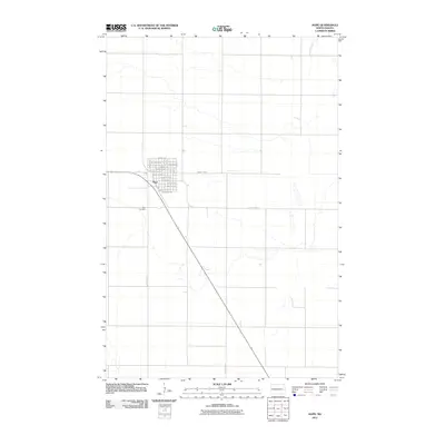
2011 Map of Hope
USGS Topo · Published 2011About this map
Hope serves as the central hub of this agricultural landscape in Steele County, North Dakota, during the early 21st century. The town's grid is meticulously detailed, showing a concentration of residences and local commerce along streets like Carpenter Blvd, Whitten Ave, and Kidder Ave. Beyond the residential core, the landscape transitions into the vast, structured section lines typical of the Red River Valley region, dominated by a network of rural routes including County Hwy-9 and County Hwy-6. The presence of the Hope Cemetery on the western edge of the settlement provides a significant point of interest for genealogists and local historians tracking the community's lineage. This era of the landscape is defined by its extreme regularity, where the survey lines of the public land system dictate the placement of every farmstead and roadway.
Find a feature on this map
29 named features on this map. Tap any name to fly to it.
Don’t see what you’re looking for? This feature index may not catch every label — zoom into the map to look around manually.
Map Details
Editions of this 2011 Hope Map
This is the sole edition of this map. No revisions or reprints were ever made.
Other maps of this area

1952 · Grand Forks
USGS Topo · 1:250,000

1956 · Grand Forks
USGS Topo · 1:250,000

1966 · Grand Forks
USGS Topo · 1:250,000

1966 · Hope SE
USGS Topo · 1:24,000

1967 · Blabon
USGS Topo · 1:24,000

1967 · Page
USGS Topo · 1:24,000
1967 · Pillsbury
USGS Topo · 1:24,000

1967 · Colgate
USGS Topo · 1:24,000

1967 · Luverne SE
USGS Topo · 1:24,000

1968 · Hope NE
USGS Topo · 1:24,000