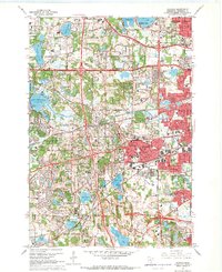
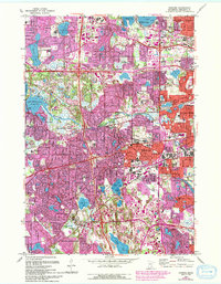
1967 Map of Hopkins
USGS Topo · Published 1969About this map
Minnehaha Creek winds through a landscape of rapid suburban expansion and established local institutions in the late 1960s. This survey of the western suburbs of Minneapolis reveals a dense network of residential development, commercial shopping centers, and prominent educational campuses like Wayzata High Sch and Westwood Jr High Sch. The region is defined by its numerous water bodies, from the expansive Lake Minnetonka Grays Bay in the west to the smaller Shady Oak Lake near Hopkins. Notable social and health facilities are present, including the Glen Lake State Sanatorium and a regional Workhouse near Parker Lake. Transportation infrastructure is dominated by the intersecting routes of the Great Northern and Chicago and North Western railroads, which share the landscape with modern thoroughfares like Excelsior Blvd. The transition from rural roots to suburban center is evident in settlements such as Minnetonka Mills and the developing residential tracts of Plymouth and Edina.
Find a feature on this map
92 named features on this map. Tap any name to fly to it.
Don’t see what you’re looking for? This feature index may not catch every label — zoom into the map to look around manually.
Map Details
Editions of this 1967 Hopkins Map
5 editions found
Other maps of this area

1896 · Minneapolis
USGS Topo · 1:62,500

1901 · Minneapolis
USGS Topo · 1:62,500

1902 · Anoka
USGS Topo · 1:62,500

1905 · Minnetonka
USGS Topo · 1:62,500

1907 · Minnetonka
USGS Topo · 1:62,500

1909 · Rockford
USGS Topo · 1:62,500

1952 · Minneapolis North
USGS Topo · 1:24,000

1952 · Minneapolis South
USGS Topo · 1:24,000

1953 · Saint Paul
USGS Topo · 1:250,000

1953 · Stillwater
USGS Topo · 1:250,000