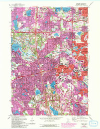
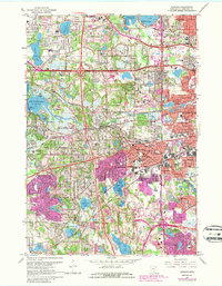
1967 Map of Hopkins
USGS Topo · Published 1994About this map
Minnetonka Mills sits at a historical crux where Minnehaha Creek flows eastward from the extensive waters of Grays Bay. This late-century revision documents the rapid suburban transformation of Hennepin County, where once-isolated settlements like Oak Knoll, Groveland, and Glen Lake have become woven into the expanding metropolitan fabric. Significant institutional presence is noted at the Glen Lake State Sanatorium and the Workhouse near Parker Lake, reflecting the diverse land use of the era.
Find a feature on this map
119 named features on this map. Tap any name to fly to it.
Don’t see what you’re looking for? This feature index may not catch every label — zoom into the map to look around manually.
Map Details
Editions of this 1967 Hopkins Map
5 editions found
Other maps of this area

1896 · Minneapolis
USGS Topo · 1:62,500

1901 · Minneapolis
USGS Topo · 1:62,500

1902 · Anoka
USGS Topo · 1:62,500

1905 · Minnetonka
USGS Topo · 1:62,500

1907 · Minnetonka
USGS Topo · 1:62,500

1909 · Rockford
USGS Topo · 1:62,500

1952 · Minneapolis North
USGS Topo · 1:24,000

1952 · Minneapolis South
USGS Topo · 1:24,000

1953 · Saint Paul
USGS Topo · 1:250,000

1953 · Stillwater
USGS Topo · 1:250,000