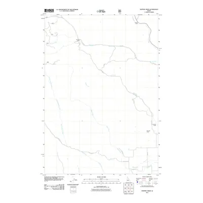
2011 Map of Hopper Creek
USGS Topo · Published 2011About this map
Hopper Creek and Keithly Creek define the drainage patterns of this rural Idaho landscape, where a network of forest and ranch roads provides access to the high gulches. In the early 21st century, the terrain remains characterized by its water sources, including the named Looney Spring and several prominent tributaries like West Pine Creek and Tamarack Creek. The naming of geographic features such as Fairchild Gulch, Surdam Gulch, and Advent Gulch suggests the influence of early homesteaders or miners who once worked these drainages. Transportation through this remote section of Washington County is facilitated by routes like Keithly Creek Rd, Cow Camp Rd, and W Pine Rd, which follow the natural contours of the land. The presence of Two Tree Gulch and Deer Creek further illustrates the descriptive naming conventions typical of the region's topographical history.
Find a feature on this map
20 named features on this map. Tap any name to fly to it.
Don’t see what you’re looking for? This feature index may not catch every label — zoom into the map to look around manually.
Map Details
Editions of this 2011 Hopper Creek Map
This is the sole edition of this map. No revisions or reprints were ever made.
Other maps of this area

1897 · Weiser
USGS Topo · 1:125,000

1953 · Mann Creek
USGS Topo · 1:62,500

1955 · Baker
USGS Topo · 1:250,000

1957 · Cambridge
USGS Topo · 1:62,500

1957 · Crane Creek Reservoir
USGS Topo · 1:62,500

1957 · Sturgill Peak
USGS Topo · 1:62,500

1959 · Baker
USGS Topo · 1:250,000

1980 · McCall
USGS Topo · 1:100,000

1980 · Weiser
USGS Topo · 1:100,000
1986 · Midvale
USGS Topo · 1:24,000