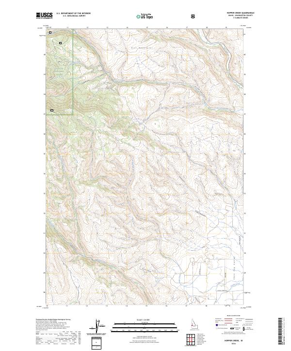
2024 Map of Hopper Creek
USGS Topo · Published 2024About this map
The Hitt Mountains dominate this high-country landscape in Washington County, where the eastern edge of the Payette National Forest transitions into open valley floors. The drainage network is dense, shaped by West Pine Creek in the north and the winding course of Keithly Creek to the south. Historically significant landmarks like Looney Spring and the distinctive Shoe Peg Valley suggest a landscape long utilized for ranching and resource management. The map details a complex system of drainage features, including Surdam Gulch, Fairchild Gulch, and Two Tree Gulch, which carve through the elevations between Tamarack Creek and Hopper Creek. Modern forest access is provided via Natl Forest Develop Road 031 Rd and Keithly Creek Rd, tracing old routes through this mountainous terrain.
Find a feature on this map
27 named features on this map. Tap any name to fly to it.
Don’t see what you’re looking for? This feature index may not catch every label — zoom into the map to look around manually.
Map Details
Editions of this 2024 Hopper Creek Map
This is the sole edition of this map. No revisions or reprints were ever made.
Other maps of this area

1897 · Weiser
USGS Topo · 1:125,000

1953 · Mann Creek
USGS Topo · 1:62,500

1955 · Baker
USGS Topo · 1:250,000

1957 · Cambridge
USGS Topo · 1:62,500

1957 · Crane Creek Reservoir
USGS Topo · 1:62,500

1957 · Sturgill Peak
USGS Topo · 1:62,500

1959 · Baker
USGS Topo · 1:250,000

1980 · McCall
USGS Topo · 1:100,000

1980 · Weiser
USGS Topo · 1:100,000
1986 · Midvale
USGS Topo · 1:24,000