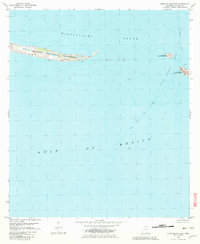
1982 Map of Horn Island East
USGS Topo · Published 1983About this map
Horn Island stretches across the northern portion of this maritime survey, illustrating the fragile geography of Mississippi’s barrier islands in the early 1980s. As part of the Gulf Islands National Seashore, the island is separated from the mainland by the Mississippi Sound and faces the open Gulf of Mexico to the south. The map details the shifting sands and underwater topography of the Horn Island Pass, a critical maritime gateway where several Lights and a deep-water Channel facilitate navigation. The eastern tip of the island and the western edge of Petit Bois Island show the dynamic nature of these coastal landforms, where tidal currents and storms continuously reshape the shoreline. This cartographic study, compiled from aerial photography and hydrographic charts, records the precise boundaries of this protected wilderness area before decades of subsequent hurricane activity further altered the archipelago.
Find a feature on this map
9 named features on this map. Tap any name to fly to it.
Don’t see what you’re looking for? This feature index may not catch every label — zoom into the map to look around manually.
Map Details
Editions of this 1982 Horn Island East Map
2 editions found
Other maps of this area

1921 · Grand Bay
USGS Topo · 1:62,500

1921 · Petit Bois Island
USGS Topo · 1:62,500

1941 · Horn Island
USGS Topo · 1:62,500

1942 · Petit Bois Island
USGS Topo · 1:62,500

1942 · Horn Island
USGS Topo · 1:62,500

1943 · Pascagoula
USGS Topo · 1:62,500

1943 · Grand Bay
USGS Topo · 1:62,500

1953 · Mobile
USGS Topo · 1:250,000

1955 · Pascagoula
USGS Topo · 1:62,500

1957 · Mobile
USGS Topo · 1:250,000