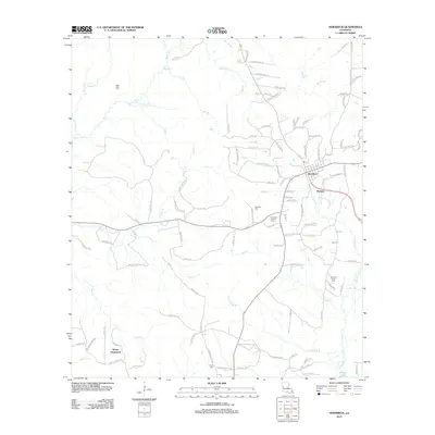
2012 Map of Hornbeck
USGS Topo · Published 2012About this map
The town of Hornbeck and the neighboring community of Barham anchor this 2012 survey of Vernon Parish, Louisiana. The landscape is defined by a dense network of tributaries including Bayou Toro, Brushy Cr, and W Anacoco Cr, which flow toward the southern expanse of Vernon Lake. The presence of the Hornbeck Lookout Tower highlights the area's forestry interests, while family and community history is preserved at Saint Lukes Cem, Beckham Cem, and Ferris Cem. Numerous local roads like Old Gristmill Rd and Scroggins Rd suggest the region's agricultural and industrial history, connecting the centralized settlements to outlying locales such as Monks Hammock. This modern topographic study documents the persistent settlement patterns and watershed connections of the region during the early twenty-first century.
Find a feature on this map
110 named features on this map. Tap any name to fly to it.
Don’t see what you’re looking for? This feature index may not catch every label — zoom into the map to look around manually.
Map Details
Editions of this 2012 Hornbeck Map
This is the sole edition of this map. No revisions or reprints were ever made.
Other maps of this area

1941 · Leesville
USGS Topo · 1:62,500

1942 · Florien
USGS Topo · 1:62,500

1943 · Leesville
USGS Topo · 1:62,500

1944 · Negreet
USGS Topo · 1:62,500

1944 · Wiergate
USGS Topo · 1:62,500

1944 · Florien
USGS Topo · 1:62,500

1946 · Leesville
USGS Topo · 1:62,500

1948 · Leesville
USGS Topo · 1:62,500

1948 · Wiergate
USGS Topo · 1:62,500

1953 · Alexandria
USGS Topo · 1:250,000