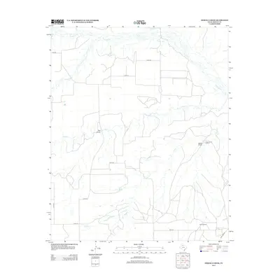
2012 Map of Hornica Creek
USGS Topo · Published 2012About this map
Hornica Creek and the North Pease River carve through this section of the Texas Rolling Plains in Motley County. The landscape is defined by a dendritic network of seasonal waterways including Quitaque Creek and Tom Ball Creek, which have sculpted features like Walker Canyon and the Red Arroyo. This 2012 survey illustrates a sparsely populated ranching environment where water management remains critical to land use, evidenced by the presence of the Walker Canyon Windmill and Dugout Windmill. Transportation is limited to a grid of county roads such as Co RD-240 and Co RD-222, with Ranch Road 94 providing the primary paved access in the southeast. The map provides a detailed view of the natural drainage patterns and the isolated landmarks that serve as essential navigational points in this expansive territory.
Find a feature on this map
17 named features on this map. Tap any name to fly to it.
Don’t see what you’re looking for? This feature index may not catch every label — zoom into the map to look around manually.
Map Details
Editions of this 2012 Hornica Creek Map
This is the sole edition of this map. No revisions or reprints were ever made.
Other maps of this area

1954 · Plainview
USGS Topo · 1:250,000

1958 · Plainview
USGS Topo · 1:250,000

1966 · Matador
USGS Topo · 1:24,000

1966 · Ballard Camp
USGS Topo · 1:24,000

1967 · North Windmill
USGS Topo · 1:24,000

1967 · Cottonwood Camp
USGS Topo · 1:24,000

1967 · Hornica Creek
USGS Topo · 1:24,000

1967 · Turtle Hole Camp
USGS Topo · 1:24,000

1967 · Flomot
USGS Topo · 1:24,000

1967 · Whiteflat
USGS Topo · 1:24,000