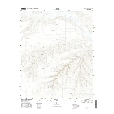
2016 Map of Hornica Creek
USGS Topo · Published 2016About this map
The N Pease River and its network of tributaries define the landscape of Motley County in this mid-2010s survey. The terrain is characterized by the complex drainage systems of Hornica Creek and Tom Ball Cr, which have carved deep into the plains to form prominent features like Walker Canyon. The small settlement of Red Arroyo sits along a tributary in the central portion of the map, connected to the surrounding ranch land by a grid of county roads. Further north, the Quitaque Cr feeds into the river system, illustrating the watershed patterns typical of the Texas Panhandle's eastern edge. The map also traces the modern transportation infrastructure, including FM 94 and numerous county routes such as Co RD 238, which provide access to this ranching and grazing territory.
Find a feature on this map
15 named features on this map. Tap any name to fly to it.
Don’t see what you’re looking for? This feature index may not catch every label — zoom into the map to look around manually.
Map Details
Editions of this 2016 Hornica Creek Map
This is the sole edition of this map. No revisions or reprints were ever made.
Other maps of this area

1954 · Plainview
USGS Topo · 1:250,000

1958 · Plainview
USGS Topo · 1:250,000

1966 · Matador
USGS Topo · 1:24,000

1966 · Ballard Camp
USGS Topo · 1:24,000

1967 · North Windmill
USGS Topo · 1:24,000

1967 · Cottonwood Camp
USGS Topo · 1:24,000

1967 · Hornica Creek
USGS Topo · 1:24,000

1967 · Turtle Hole Camp
USGS Topo · 1:24,000

1967 · Flomot
USGS Topo · 1:24,000

1967 · Whiteflat
USGS Topo · 1:24,000