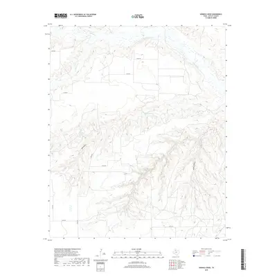
2019 Map of Hornica Creek
USGS Topo · Published 2019About this map
N Pease River and its seasonal tributaries carve a complex drainage system through this portion of Motley County. The landscape is defined by significant erosion features, most notably Walker Canyon in the southeast and the Red Arroyo to the west. While much of the land is accessed via a network of county roads like Co RD 232 and Co RD 228, the primary paved artery is Fm 94 in the southern reaches. The intricate contouring along Hornica Cr and Tom Ball Cr illustrates the rugged break-country typical of the rolling plains, where water has deeply incised the local topography over time. This 2019 survey provides a clear view of the modern rural infrastructure, showing how local ranch roads navigate the draws and ridges between Quitaque Cr and the larger river basin.
Find a feature on this map
15 named features on this map. Tap any name to fly to it.
Don’t see what you’re looking for? This feature index may not catch every label — zoom into the map to look around manually.
Map Details
Editions of this 2019 Hornica Creek Map
This is the sole edition of this map. No revisions or reprints were ever made.
Other maps of this area

1954 · Plainview
USGS Topo · 1:250,000

1958 · Plainview
USGS Topo · 1:250,000

1966 · Matador
USGS Topo · 1:24,000

1966 · Ballard Camp
USGS Topo · 1:24,000

1967 · North Windmill
USGS Topo · 1:24,000

1967 · Cottonwood Camp
USGS Topo · 1:24,000

1967 · Hornica Creek
USGS Topo · 1:24,000

1967 · Turtle Hole Camp
USGS Topo · 1:24,000

1967 · Flomot
USGS Topo · 1:24,000

1967 · Whiteflat
USGS Topo · 1:24,000