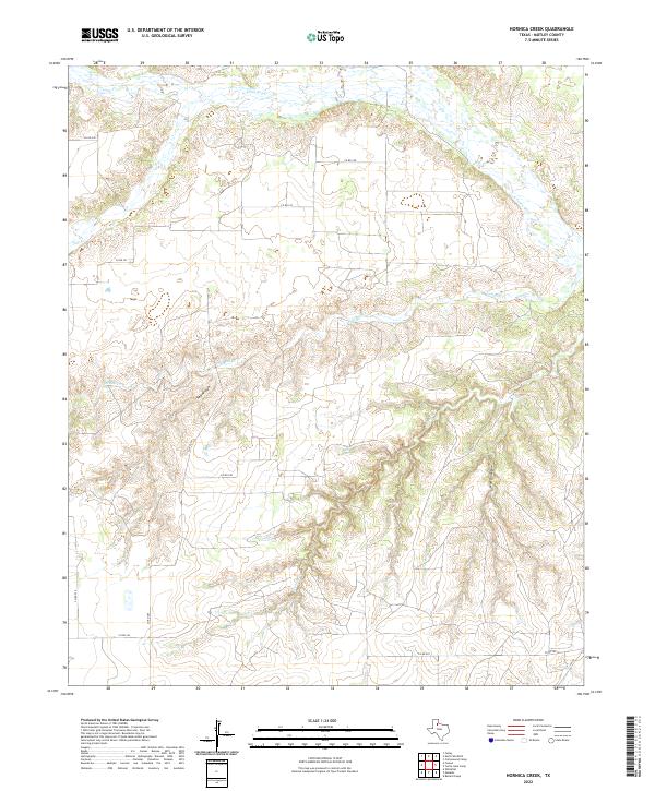
2022 Map of Hornica Creek
USGS Topo · Published 2022About this map
The N Pease River meanders across the northern reaches of this landscape in Motley County, carving a wide valley floor through the West Texas plains. The drainage network is particularly dense here, defined by the dendritic patterns of Hornica Cr and Tom Ball Cr as they cut through the local break in the terrain. Significant geographic depressions like Walker Canyon and the Red Arroyo characterize the eastern and central portions of the map, illustrating the erosional forces typical of this region. Human presence is marked primarily by a grid of rural routes such as Co RD 232 and Co RD 228, which provide access across the mesas and canyons to the south of the river, eventually connecting to Fm 94 in the southeast corner.
Find a feature on this map
15 named features on this map. Tap any name to fly to it.
Don’t see what you’re looking for? This feature index may not catch every label — zoom into the map to look around manually.
Map Details
Editions of this 2022 Hornica Creek Map
This is the sole edition of this map. No revisions or reprints were ever made.
Other maps of this area

1954 · Plainview
USGS Topo · 1:250,000

1958 · Plainview
USGS Topo · 1:250,000

1966 · Matador
USGS Topo · 1:24,000

1966 · Ballard Camp
USGS Topo · 1:24,000

1967 · North Windmill
USGS Topo · 1:24,000

1967 · Cottonwood Camp
USGS Topo · 1:24,000

1967 · Hornica Creek
USGS Topo · 1:24,000

1967 · Turtle Hole Camp
USGS Topo · 1:24,000

1967 · Flomot
USGS Topo · 1:24,000

1967 · Whiteflat
USGS Topo · 1:24,000