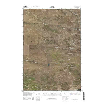
2014 Map of Horse Butte
USGS Topo · Published 2014About this map
Horse Butte dominates the central-western portion of this Stillwater County landscape, serving as a prominent landmark for the surrounding drainage systems. The area is defined by a network of seasonal and perennial waterways, including the upper reaches of N Fork Cottonwood Cr and S Fork Cottonwood Cr, which carve through the terrain alongside Tilden Cr and Swamp Cr. A remote road network reflects modern residential development and land use, with labels such as Paradise Bluff Rd, Crazy Mountain Vista Rd, and Wild Turkey Ridge Rd suggesting the character of these rural subdivisions. Near the eastern edge, Shearing Pen Spring provides a specific point of interest for those tracing the history of local ranching and water rights in this part of Montana.
Find a feature on this map
28 named features on this map. Tap any name to fly to it.
Don’t see what you’re looking for? This feature index may not catch every label — zoom into the map to look around manually.
Map Details
Editions of this 2014 Horse Butte Map
This is the sole edition of this map. No revisions or reprints were ever made.
Other maps of this area

1892 · Stillwater
USGS Topo · 1:125,000

1954 · Billings
USGS Topo · 1:250,000

1956 · Hunter Lake
USGS Topo · 1:24,000

1956 · Shane Ridge
USGS Topo · 1:24,000

1956 · Horse Butte
USGS Topo · 1:24,000

1956 · Molt
USGS Topo · 1:24,000

1956 · Columbus East
USGS Topo · 1:24,000

1956 · Rapids
USGS Topo · 1:24,000

1956 · Park City
USGS Topo · 1:24,000
1956 · Wheat Basin SW
USGS Topo · 1:24,000