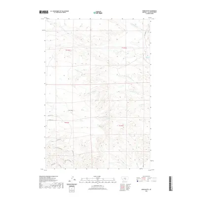
2020 Map of Horse Butte
USGS Topo · Published 2020About this map
Horse Butte rises as a prominent landmark in this Stillwater County landscape, where the high plains transition into a series of drainage basins. The area is defined by its complex hydrology, with the S Fork Cottonwood Cr and N Fork Cottonwood Cr cutting through the terrain. A legacy of ranching and land use is evident in features like Shearing Pen Spring and numerous named local routes such as Youngs Point Rd and Valley Creek Rd. In the southern portion of the sheet, the topography becomes more pronounced at High Pines Bluff, overlooking several small tributaries including Horse Cr and Allen Cr. The naming conventions found on roads like Wild Turkey Ridge Rd and Bugling Elk LN reflect the local fauna and the character of this rural Montana territory.
Find a feature on this map
24 named features on this map. Tap any name to fly to it.
Don’t see what you’re looking for? This feature index may not catch every label — zoom into the map to look around manually.
Map Details
Editions of this 2020 Horse Butte Map
This is the sole edition of this map. No revisions or reprints were ever made.
Other maps of this area

1892 · Stillwater
USGS Topo · 1:125,000

1954 · Billings
USGS Topo · 1:250,000

1956 · Hunter Lake
USGS Topo · 1:24,000

1956 · Shane Ridge
USGS Topo · 1:24,000

1956 · Horse Butte
USGS Topo · 1:24,000

1956 · Molt
USGS Topo · 1:24,000

1956 · Columbus East
USGS Topo · 1:24,000

1956 · Rapids
USGS Topo · 1:24,000

1956 · Park City
USGS Topo · 1:24,000
1956 · Wheat Basin SW
USGS Topo · 1:24,000