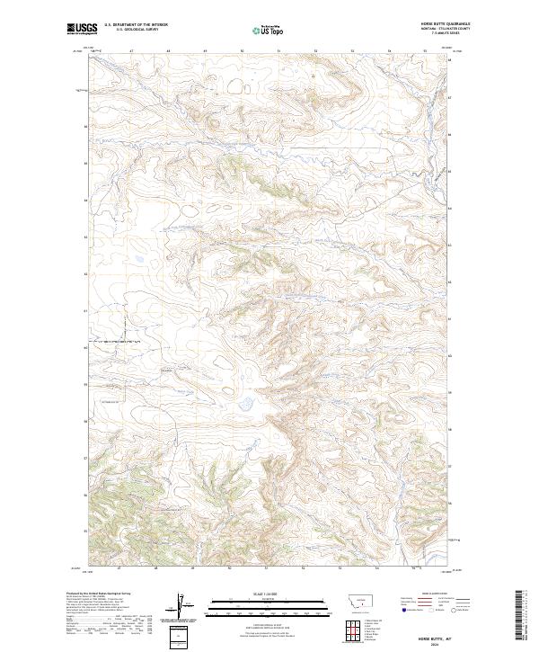
2024 Map of Horse Butte
USGS Topo · Published 2024About this map
Horse Butte rises as a prominent landmark in this Stillwater County landscape, where the headwaters of numerous drainages carve through the terrain. The hydrological pattern is remarkably dense, defined by the diverging paths of Horse Creek, Swamp Creek, and Tilden Creek. This 2024 survey captures the intersection of traditional land use and modern residential development, visible in the network of roads such as October Hill Ln and Wild Turkey Ridge Rd that wind through the southern hills. To the north, the terrain is dominated by the seasonal and permanent flows of South Fork Cottonwood Creek and North Fork Cottonwood Creek. Evidence of local timber history or industrial labor is preserved in names like Sawmill Gulch, while agricultural water management is anchored by the Cove Ditch in the southeastern corner.
Find a feature on this map
26 named features on this map. Tap any name to fly to it.
Don’t see what you’re looking for? This feature index may not catch every label — zoom into the map to look around manually.
Map Details
Editions of this 2024 Horse Butte Map
This is the sole edition of this map. No revisions or reprints were ever made.
Other maps of this area

1892 · Stillwater
USGS Topo · 1:125,000

1954 · Billings
USGS Topo · 1:250,000

1956 · Hunter Lake
USGS Topo · 1:24,000

1956 · Shane Ridge
USGS Topo · 1:24,000

1956 · Horse Butte
USGS Topo · 1:24,000

1956 · Molt
USGS Topo · 1:24,000

1956 · Columbus East
USGS Topo · 1:24,000

1956 · Rapids
USGS Topo · 1:24,000

1956 · Park City
USGS Topo · 1:24,000
1956 · Wheat Basin SW
USGS Topo · 1:24,000