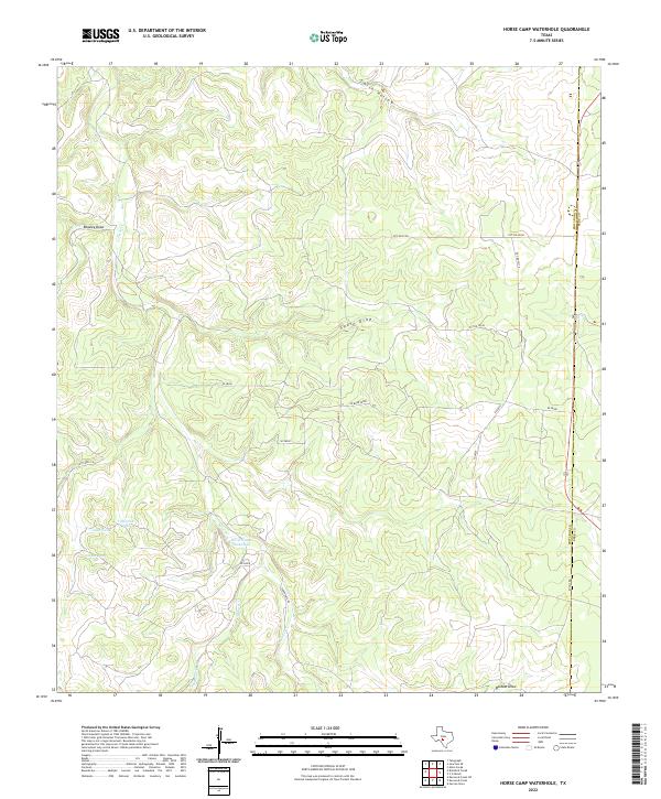
2022 Map of Horse Camp Waterhole
USGS Topo · Published 2022About this map
The Horse Camp Waterhole serves as a central landmark in this high-altitude section of the Edwards Plateau. Defined by a network of seasonal drainages, the landscape is carved by deep incisions such as Smith Hollow, Beasley Draw, and Lydle Draw. These ephemeral waterways, including Paint Cr and its tributary Hunger Cr, are critical to the ranching operations that have historically shaped this region. Evidence of local water management is seen in the series of stock tanks, such as Goat Tank, Valentine Tank, and Cedar Tank, which provide vital resources for livestock in an arid environment.
Find a feature on this map
25 named features on this map. Tap any name to fly to it.
Don’t see what you’re looking for? This feature index may not catch every label — zoom into the map to look around manually.
Map Details
Editions of this 2022 Horse Camp Waterhole Map
This is the sole edition of this map. No revisions or reprints were ever made.
Other maps of this area

1926 · Segovia 2-c
USGS Topo · 1:48,000

1932 · Junction
USGS Topo · 1:62,500

1954 · Llano
USGS Topo · 1:250,000

1955 · Llano
USGS Topo · 1:250,000

1956 · Llano
USGS Topo · 1:250,000

1963 · Garven Store
USGS Topo · 1:24,000

1963 · Y O Ranch
USGS Topo · 1:24,000
1971 · Bradford Creek
USGS Topo · 1:24,000
1971 · Earwood Creek
USGS Topo · 1:24,000
1971 · Horse Camp Waterhole
USGS Topo · 1:24,000