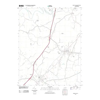
2010 Map of Horse Cave
USGS Topo · Published 2010About this map
Horse Cave and Cave City anchor this portrait of the Barren County landscape, situated where the karst topography of the Pennyroyal Plateau meets the corridor of the Green River. The northern boundary is defined by the winding river at Lawler Bend, while the interior terrain is marked by numerous sinkholes and knobs, including Vial Knob, Gossett Knob, and Huckleberry Knob. The map reveals the intricate relationship between the region's unique geology and its development, with the Horse Cave Lookout Tower standing as a sentinel over the karst plain.
Find a feature on this map
50 named features on this map. Tap any name to fly to it.
Don’t see what you’re looking for? This feature index may not catch every label — zoom into the map to look around manually.
Map Details
Editions of this 2010 Horse Cave Map
This is the sole edition of this map. No revisions or reprints were ever made.
Other maps of this area

1922 · Mammoth Cave
USGS Topo · 1:62,500

1923 · Mammoth Cave
USGS Topo · 1:62,500

1925 · Cub Run
USGS Topo · 1:62,500

1934 · Munfordville
USGS Topo · 1:48,000

1935 · Horse Cave
USGS Topo · 1:48,000

1937 · Munfordville
USGS Topo · 1:62,500

1938 · Horse Cave
USGS Topo · 1:62,500

1953 · Munfordville
USGS Topo · 1:24,000
1953 · Canmer
USGS Topo · 1:24,000

1954 · Evansville
USGS Topo · 1:250,000