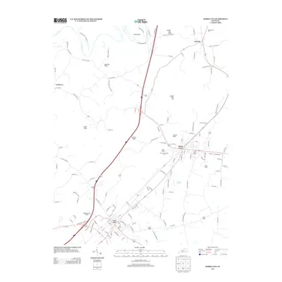
2013 Map of Horse Cave
USGS Topo · Published 2013About this map
Cave City and Horse Cave anchor this 2013 topographic study of the Karst landscape in Barren and Hart Counties. The region is defined by its complex subterranean topography, evidenced by features such as London Pace Sink and numerous knobs including Summer Seat Knob, Gossett Knob, and Pine Knob. The CSX Transportation rail line parallels the main highway corridor, connecting the established settlements of Rowletts and Northtown to the larger town centers.
Find a feature on this map
126 named features on this map. Tap any name to fly to it.
Don’t see what you’re looking for? This feature index may not catch every label — zoom into the map to look around manually.
Map Details
Editions of this 2013 Horse Cave Map
This is the sole edition of this map. No revisions or reprints were ever made.
Other maps of this area

1922 · Mammoth Cave
USGS Topo · 1:62,500

1923 · Mammoth Cave
USGS Topo · 1:62,500

1925 · Cub Run
USGS Topo · 1:62,500

1934 · Munfordville
USGS Topo · 1:48,000

1935 · Horse Cave
USGS Topo · 1:48,000

1937 · Munfordville
USGS Topo · 1:62,500

1938 · Horse Cave
USGS Topo · 1:62,500

1953 · Munfordville
USGS Topo · 1:24,000
1953 · Canmer
USGS Topo · 1:24,000

1954 · Evansville
USGS Topo · 1:250,000