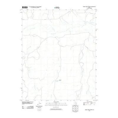
2010 Map of Horse Creek North
USGS Topo · Published 2010About this map
McMordie Lake sits as a central water feature in this portion of the Texas Panhandle, regulated by the McMordie Lake Dam. The landscape is defined by the winding course of the Canadian River, which is fed by an intricate network of drainage systems including Three Corrals Creek and Horse Creek. This survey captures the rural character of Roberts County during a period where large-scale ranching operations are reflected in the naming of local landmarks such as Pickett Ranch Creek and Home Ranch Creek. Access through this remote terrain is maintained by a series of private and ranch roads, including Payne Ranch Rd and N River Rd, which follow the natural contours of the river valley and its many tributaries like Point Creek and Hackberry Creek.
Find a feature on this map
12 named features on this map. Tap any name to fly to it.
Don’t see what you’re looking for? This feature index may not catch every label — zoom into the map to look around manually.
Map Details
Editions of this 2010 Horse Creek North Map
This is the sole edition of this map. No revisions or reprints were ever made.
Other maps of this area

1954 · Perryton
USGS Topo · 1:250,000

1954 · Amarillo
USGS Topo · 1:250,000

1958 · Perryton
USGS Topo · 1:250,000

1958 · Amarillo
USGS Topo · 1:250,000

1971 · Dry Creek SE
USGS Topo · 1:24,000

1971 · Dry Creek NE
USGS Topo · 1:24,000

1972 · Washburn Arroyo
USGS Topo · 1:24,000

1972 · Horse Creek North
USGS Topo · 1:24,000

1972 · East Dry Creek
USGS Topo · 1:24,000
1972 · Horse Creek South
USGS Topo · 1:24,000