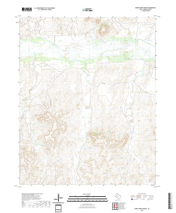
2022 Map of Horse Creek North
USGS Topo · Published 2022About this map
The braided channel of the Canadian River dominates the northern reaches of this Roberts County landscape, carving through the Panhandle plains. The terrain is defined by a dense network of drainage systems, most notably Horse Cr and the multi-branched Three Corrals Cr, which feed toward the river valley from the south. This area maintains a strong ranching character, evident in the naming of features such as Pickett Ranch Cr, Home Ranch Cr, and Payne Ranch Rd. One of the few standing bodies of water in this arid stretch is McMordie Lake, situated amidst the undulating contours south of the river. The lack of concentrated settlements highlights the expansive, open-range nature of this part of Texas, where land use is dictated by the availability of seasonal water sources like Point Creek and Hackberry Cr.
Find a feature on this map
12 named features on this map. Tap any name to fly to it.
Don’t see what you’re looking for? This feature index may not catch every label — zoom into the map to look around manually.
Map Details
Editions of this 2022 Horse Creek North Map
This is the sole edition of this map. No revisions or reprints were ever made.
Other maps of this area

1954 · Perryton
USGS Topo · 1:250,000

1954 · Amarillo
USGS Topo · 1:250,000

1958 · Perryton
USGS Topo · 1:250,000

1958 · Amarillo
USGS Topo · 1:250,000

1971 · Dry Creek SE
USGS Topo · 1:24,000

1971 · Dry Creek NE
USGS Topo · 1:24,000

1972 · Washburn Arroyo
USGS Topo · 1:24,000

1972 · Horse Creek North
USGS Topo · 1:24,000

1972 · East Dry Creek
USGS Topo · 1:24,000
1972 · Horse Creek South
USGS Topo · 1:24,000