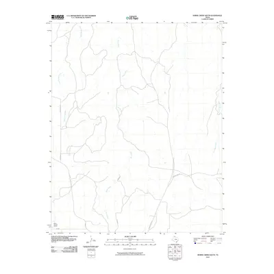
2010 Map of Horse Creek South
USGS Topo · Published 2010About this map
Horse Creek and its tributaries carve a distinct drainage pattern through this section of Roberts County, shaping the local ranching landscape. The map highlights a network of essential rural transport routes, including Payne Ranch Rd and Rankin Rd, which connect the isolated homesteads and grazing lands. A significant modern landmark, the Willis N Clark Airport, is located in the southwestern corner, serving as a vital link for this sparsely populated region. The presence of Three Corrals Creek and Home Ranch Creek suggests the historical importance of water access for livestock in this Texas Panhandle territory. The layout of state roads like FM 283 and FM 2699 reflects the structured development of the area's transit system to support the local agricultural economy.
Find a feature on this map
9 named features on this map. Tap any name to fly to it.
Don’t see what you’re looking for? This feature index may not catch every label — zoom into the map to look around manually.
Map Details
Editions of this 2010 Horse Creek South Map
This is the sole edition of this map. No revisions or reprints were ever made.
Other maps of this area

1954 · Amarillo
USGS Topo · 1:250,000

1958 · Amarillo
USGS Topo · 1:250,000

1967 · Lora
USGS Topo · 1:24,000

1971 · Dry Creek SE
USGS Topo · 1:24,000

1971 · Dry Creek NE
USGS Topo · 1:24,000

1972 · Washburn Arroyo
USGS Topo · 1:24,000

1972 · Horse Creek North
USGS Topo · 1:24,000

1972 · East Dry Creek
USGS Topo · 1:24,000

1972 · Pampa NE
USGS Topo · 1:24,000

1972 · Miami
USGS Topo · 1:24,000