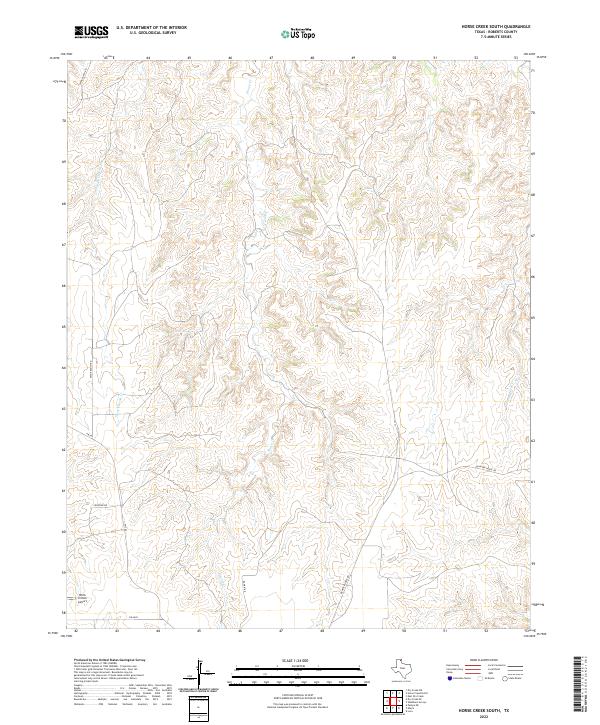
2022 Map of Horse Creek South
USGS Topo · Published 2022About this map
Horse Cr winds through this section of Roberts County, defining a landscape marked by deep drainages and tributary systems like Three Corrals Cr and Home Ranch Cr. The terrain is shaped by the cattle-ranching heritage of the Texas Panhandle, with property access maintained through named routes such as Payne Ranch Rd and Quarter Horse Rd. Near the southern edge of the quadrangle, Willis N Clark Airport sits adjacent to Fm 2699, serving as a remote aviation point for the surrounding plains. The network of local roads including Lonestar Rd and Rankin Rd illustrates the modern infrastructure supporting large-scale landholdings in this sparsely populated region of the High Plains.
Find a feature on this map
10 named features on this map. Tap any name to fly to it.
Don’t see what you’re looking for? This feature index may not catch every label — zoom into the map to look around manually.
Map Details
Editions of this 2022 Horse Creek South Map
This is the sole edition of this map. No revisions or reprints were ever made.
Other maps of this area

1954 · Amarillo
USGS Topo · 1:250,000

1958 · Amarillo
USGS Topo · 1:250,000

1967 · Lora
USGS Topo · 1:24,000

1971 · Dry Creek SE
USGS Topo · 1:24,000

1971 · Dry Creek NE
USGS Topo · 1:24,000

1972 · Washburn Arroyo
USGS Topo · 1:24,000

1972 · Horse Creek North
USGS Topo · 1:24,000

1972 · East Dry Creek
USGS Topo · 1:24,000

1972 · Pampa NE
USGS Topo · 1:24,000

1972 · Miami
USGS Topo · 1:24,000