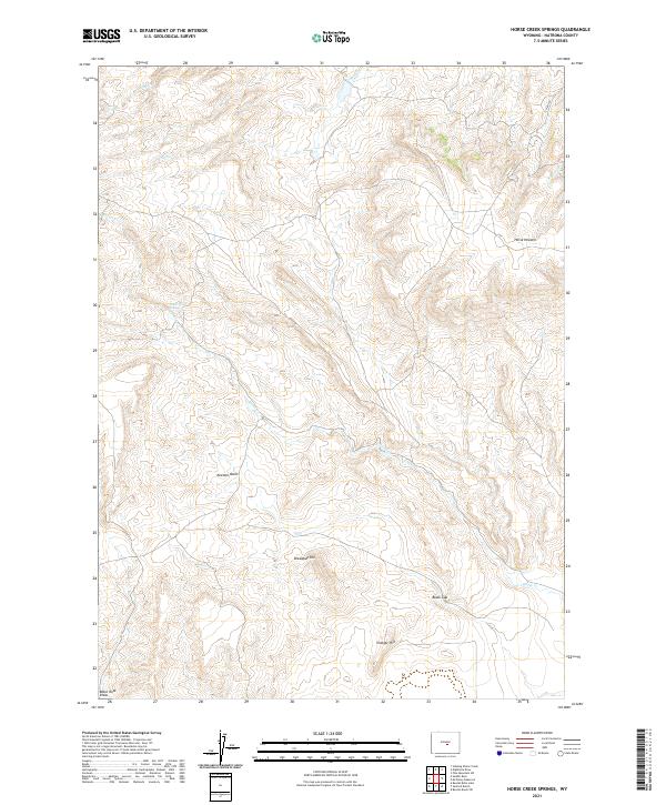
2021 Map of Horse Creek Springs
USGS Topo · Published 2021About this map
Horse Creek Springs serves as a focal point in this high-elevation landscape of central Wyoming, where the drainage of Horse Cr carves through the local topography. The area is defined by its distinct landforms, ranging from the depressions of Keester Basin to prominent rises like Breadpan Hill and Vinegar Hill. The map illustrates a network of seasonal and perennial waterways including Soap Cr, Cabin Cr, and Austin Cr that navigate the varied elevations. Human infrastructure is sparse, represented primarily by the alignment of Co RD 320 in the northeastern corner. The naming of features like Horse Heaven and Black Gap reflects a local nomenclature tied to the terrain's usability for livestock and passage, providing a detailed record of the Natrona County ranching environment in the early twenty-first century.
Find a feature on this map
16 named features on this map. Tap any name to fly to it.
Don’t see what you’re looking for? This feature index may not catch every label — zoom into the map to look around manually.
Map Details
Editions of this 2021 Horse Creek Springs Map
This is the sole edition of this map. No revisions or reprints were ever made.
Other maps of this area

1951 · Pine Mountain SW
USGS Topo · 1:24,000

1951 · Benton Basin SW
USGS Topo · 1:24,000

1951 · Mc Cleary Reservoir
USGS Topo · 1:24,000

1955 · Casper
USGS Topo · 1:250,000

1958 · Casper
USGS Topo · 1:250,000

1959 · Eightmile Draw
USGS Topo · 1:24,000

1959 · Horse Creek Springs
USGS Topo · 1:24,000

1959 · Sanford Ranch
USGS Topo · 1:24,000
1959 · Stinking Water Creek
USGS Topo · 1:24,000

1959 · Saddle Rock
USGS Topo · 1:24,000