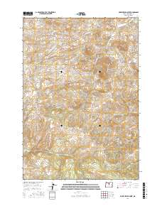
2017 Map of Horse Heaven Creek
USGS Topo · Published 2017About this map
Kilts sits at the northern edge of this high-desert landscape in Jefferson County, where the terrain is defined by a dense concentration of volcanic buttes and deeply cut canyons. The drainage network is particularly striking, with the central Horse Heaven Creek joined by Little Muddy Cr and Hawley Cr as they carve through the uplands. Water sources in this arid environment are highly localized, appearing as named points like Sand Spring, Box Springs, and Buttercup Spring.
Find a feature on this map
43 named features on this map. Tap any name to fly to it.
Don’t see what you’re looking for? This feature index may not catch every label — zoom into the map to look around manually.
Map Details
Editions of this 2017 Horse Heaven Creek Map
This is the sole edition of this map. No revisions or reprints were ever made.
Other maps of this area

1926 · Mitchell
USGS Topo · 1:125,000

1955 · Bend
USGS Topo · 1:250,000

1957 · Bend
USGS Topo · 1:250,000

1958 · Bend
USGS Topo · 1:250,000

1966 · Antelope
USGS Topo · 1:62,500

1966 · Clarno
USGS Topo · 1:62,500

1968 · Horse Heaven Creek
USGS Topo · 1:24,000

1968 · Axehandle Butte
USGS Topo · 1:24,000

1968 · Dutchman Creek
USGS Topo · 1:24,000

1968 · Stephenson Mtn
USGS Topo · 1:24,000