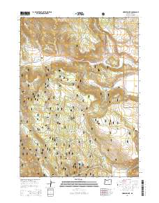
2014 Map of Horse Prairie
USGS Topo · Published 2014About this map
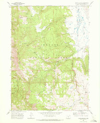
Fremont National Forest dominates this section of the High Desert, where high-elevation meadowlands and vital water sources defined early ranching and forestry. Notable settlements and stopping points like Horse Prairie, Whiskey Flat, and Summit Prairie are centers of gravity in a landscape carved by Camas Cr and Whiskey Cr. The distribution of natural and improved water sources, including Parallel Spring and Hickey Reservoir, illustrates the essential infrastructure required for survival and industry in this arid environment. Roads like the Warner Hwy and State Hwy 140 (also marked as Or-140) provide the primary transit through the forest, connecting these isolated flats and springs. Local history researchers can trace the movement of livestock and timber through landmarks such as Rosger Meadow and Bowers Bridge Cr, providing insight into the seasonal use of these mountain basins.
Find a feature on this map
34 named features on this map. Tap any name to fly to it.
Don’t see what you’re looking for? This feature index may not catch every label — zoom into the map to look around manually.
Map Details
Editions of this 2014 Horse Prairie Map
This is the sole edition of this map. No revisions or reprints were ever made.
Other maps of this area

1955 · Klamath Falls
USGS Topo · 1:250,000

1958 · Klamath Falls
USGS Topo · 1:250,000

1964 · Lakeview NE
USGS Topo · 1:24,000

1964 · Crooked Creek Valley
USGS Topo · 1:24,000
1964 · Crane Creek
USGS Topo · 1:24,000
1968 · Sage Hen Butte
USGS Topo · 1:24,000

1968 · Crook Peak
USGS Topo · 1:24,000
1968 · Horse Prairie
USGS Topo · 1:24,000
1968 · Crane Mountain
USGS Topo · 1:24,000
1968 · Drake Peak
USGS Topo · 1:24,000