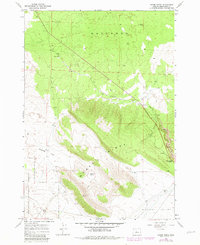
1967 Map of Horse Ridge
USGS Topo · Published 1981About this map
Horse Ridge dominates this Central Oregon landscape, standing as a prominent geological divide between the high desert plateaus. This 1967 survey, updated with revisions from 1979, illustrates a region defined by its arid geography and specific water management features like Dyer Well and Dry Well. To the north, the Badlands present a stark, fragmented terrain, while the southern portion of the map transitions into the Millican Valley. Evidence of land use and resource extraction is visible through several marked Borrow Pits, which likely supported road construction in this sparsely populated area. The presence of the Deschutes National Forest boundary and the Jeep Trail suggests a landscape navigated primarily for transit, timber management, or recreation, centered around the high point at Horse Ridge Summit. Localized depressions such as Golden Basin and the broad expanse of Stookey Flat further detail the varied topography of this volcanic region.
Find a feature on this map
13 named features on this map. Tap any name to fly to it.
Don’t see what you’re looking for? This feature index may not catch every label — zoom into the map to look around manually.
Map Details
Editions of this 1967 Horse Ridge Map
3 editions found
Other maps of this area

1926 · Bend
USGS Topo · 1:125,000

1929 · Bend
USGS Topo · 1:125,000

1931 · Newberry Crater
USGS Topo · 1:125,000

1935 · Newberry Crater
USGS Topo · 1:125,000

1955 · Crescent
USGS Topo · 1:250,000

1955 · Bend
USGS Topo · 1:250,000

1957 · Crescent
USGS Topo · 1:250,000

1957 · Bend
USGS Topo · 1:250,000

1958 · Crescent
USGS Topo · 1:250,000

1958 · Bend
USGS Topo · 1:250,000