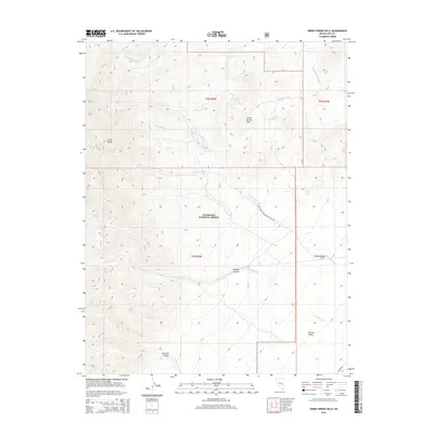
2014 Map of Horse Spring Hills
USGS Topo · Published 2014About this map
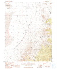
The Grant Range dominates the western topography of this Nevada high-country landscape, where steep slopes descend into the broad expanse of Garden Valley. Within the protected boundaries of the Humboldt National Forest, the terrain is defined by a complex network of seasonal drainages, including the prominent Sherwood Wash and Scofield Wash. The map reveals a reliance on isolated water sources typical of the Great Basin, marking numerous specific points such as Big Spring, Wiregrass Spring, and Bear Trap Spring. These features, along with Horse Spring in the eponymous Horse Spring Hills, trace the fundamental hydrology that sustained early movement through these basins. The presence of Rimrock Canyon and Scofield Canyon suggests a landscape of significant relief, where Natl Forest Develop Road 648 BD provides one of the few managed routes through the interior.
Find a feature on this map
28 named features on this map. Tap any name to fly to it.
Don’t see what you’re looking for? This feature index may not catch every label — zoom into the map to look around manually.
Map Details
Editions of this 2014 Horse Spring Hills Map
This is the sole edition of this map. No revisions or reprints were ever made.
Other maps of this area

1956 · Lund
USGS Topo · 1:250,000

1960 · Lund
USGS Topo · 1:250,000

1964 · Troy Canyon
USGS Topo · 1:62,500

1964 · Forest Home
USGS Topo · 1:62,500

1985 · Adaven
USGS Topo · 1:24,000
1985 · Water Gap NW
USGS Topo · 1:24,000
1985 · Water Gap NE
USGS Topo · 1:24,000

1988 · Quinn Canyon Range
USGS Topo · 1:100,000
1990 · Troy Canyon
USGS Topo · 1:24,000
1990 · Bullwhacker Springs
USGS Topo · 1:24,000