
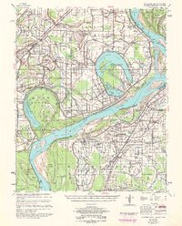
1954 Map of Horseshoe Lake
USGS Topo · Published 1954About this map
Mississippi River floodplains along the Arkansas-Mississippi border define this mid-century landscape, dominated by the massive oxbow of Horseshoe Lake. The region is a dense network of agricultural holdings, where large-scale operations like Green River Plantation and Snowden Plantation sit alongside family-named tracts such as Davis Biggs Farm and Sycamore Bend Farm. The map reveals a deeply established rural social structure, evidenced by the high frequency of combined institutions such as St. Marys Missionary Ch Sch & Cem and Crystal Springs Ch Sch & Cem. Transport is tied to the water and the rails, with river traffic marked by Pinckney Ldg and Bruins Ldg, while the St. Louis San Francisco RR cuts through the western portion of the quadrangle near Hughes. The complexity of the river’s shifting course is captured in the numerous chutes and backwaters, including Buck Island Chute and Happy Jack Lake.
Find a feature on this map
145 named features on this map. Tap any name to fly to it.
Don’t see what you’re looking for? This feature index may not catch every label — zoom into the map to look around manually.
Map Details
Editions of this 1954 Horseshoe Lake Map
2 editions found
Other maps of this area

1908 · Hollywood
USGS Topo · 1:24,000

1908 · Lake Cormorant
USGS Topo · 1:24,000

1912 · Lake Cormorant
USGS Topo · 1:31,680

1913 · Hollywood
USGS Topo · 1:31,680

1916 · Memphis
USGS Topo · 1:62,500

1925 · Memphis
USGS Topo · 1:48,000

1927 · Memphis
USGS Topo · 1:62,500

1931 · Horseshoe Lake
USGS Topo · 1:62,500

1932 · Horn Lake
USGS Topo · 1:48,000

1932 · Crenshaw
USGS Topo · 1:62,500