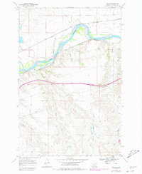
1968 Map of Horton
USGS Topo · Published 1980About this map
The Yellowstone River cuts a wide, braided path through this Custer County landscape, serving as a primary corridor for both natural drainage and industrial transport. The settlement at Horton sits along the southern bank, while the small stop of Paragon is located in the northeastern corner. This era is defined by the heavy rail presence flanking the river, with the Chicago Milwaukee and the Burlington Northern lines tracing the valley floor. To the north, the St Paul and Pacific further emphasizes the importance of this transit artery during the late 1960s.
Find a feature on this map
21 named features on this map. Tap any name to fly to it.
Don’t see what you’re looking for? This feature index may not catch every label — zoom into the map to look around manually.
Map Details
Editions of this 1968 Horton Map
2 editions found

Other maps of this area

1953 · Miles City
USGS Topo · 1:250,000

1954 · Forsyth
USGS Topo · 1:250,000

1957 · Miles City
USGS Topo · 1:250,000

1957 · Forsyth
USGS Topo · 1:250,000

1958 · Miles City
USGS Topo · 1:250,000

1958 · Forsyth
USGS Topo · 1:250,000

1968 · Hathaway
USGS Topo · 1:24,000

1968 · Big Hill
USGS Topo · 1:24,000

1968 · Lignite Creek
USGS Topo · 1:24,000

1968 · Butterfly Creek
USGS Topo · 1:24,000