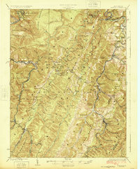
1924 Map of Horton
USGS Topo · Published 1924About this map
The Monongahela National Forest dominates this highland landscape, where the Western Maryland RR follows the winding course of Shaffers Fork. In the early 1920s, this region was a hub of timber and rail activity, evidenced by settlements like Evenwood, Bemis, and Horton. The map documents a distributed network of rural education and faith, featuring locations such as Mylius School, Pennington School, and Bethel Church.
Find a feature on this map
98 named features on this map. Tap any name to fly to it.
Don’t see what you’re looking for? This feature index may not catch every label — zoom into the map to look around manually.
Map Details
Editions of this 1924 Horton Map
2 editions found

Other maps of this area

1886 · St. George
USGS Topo · 1:125,000

1889 · Beverly
USGS Topo · 1:125,000

1891 · St. George
USGS Topo · 1:125,000

1892 · Beverly
USGS Topo · 1:125,000

1892 · Franklin
USGS Topo · 1:125,000

1895 · Piedmont
USGS Topo · 1:125,000

1896 · Franklin
USGS Topo · 1:125,000

1907 · Belington
USGS Topo · 1:62,500

1908 · Parsons
USGS Topo · 1:62,500

1909 · Elkins
USGS Topo · 1:62,500