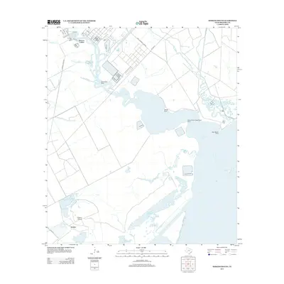
2013 Map of Hoskins Mound
USGS Topo · Published 2013About this map
Peterson Landing and the industrial installation of the Amoco Chemical Company define the northern portion of this coastal Brazoria County landscape. The map details a complex hydrologic network where Chocolate Bayou and Cottonwood Bayou feed into the broader waters of Chocolate Bay. Navigation and commerce are central to the area's layout, evidenced by the Horseshoe Bend Marina and the various landings along the winding waterways.
Find a feature on this map
28 named features on this map. Tap any name to fly to it.
Don’t see what you’re looking for? This feature index may not catch every label — zoom into the map to look around manually.
Map Details
Editions of this 2013 Hoskins Mound Map
This is the sole edition of this map. No revisions or reprints were ever made.
Other maps of this area

1929 · Karankawa Lake
USGS Topo · 1:24,000

1929 · Hitchcock
USGS Topo · 1:24,000

1932 · Hitchcock
USGS Topo · 1:31,680

1932 · Mustang Bayou
USGS Topo · 1:31,680

1933 · Karankawa Lake
USGS Topo · 1:31,680

1933 · San Luis Pass
USGS Topo · 1:31,680

1943 · San Luis Pass
USGS Topo · 1:31,680

1943 · Oyster Creek
USGS Topo · 1:31,680

1943 · Danbury
USGS Topo · 1:31,680

1943 · Mustang Bayou
USGS Topo · 1:31,680