
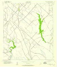
1943 Map of Mustang Bayou
USGS Topo · Published 1943About this map
Low-lying coastal plains along the Galveston Brazoria county line are defined by a complex network of slow-moving waterways and early drainage infrastructure. The Missouri Pacific Road cuts a straight diagonal across the terrain, serving as a primary transit corridor alongside the Liverpool Algoa Road. Water management is central to the landscape, evidenced by the Briscoe Canal and a Pumping Sta located near the southern reaches of New Bayou. These features supported the agricultural and ranching operations of the mid-20th century. Local family and community history is anchored by the German Cem in the northern sector, while the winding courses of Mustang Bayou, Halls Bayou, and Chocolate Bayou dictate the natural boundaries of the prairie.
Find a feature on this map
19 named features on this map. Tap any name to fly to it.
Don’t see what you’re looking for? This feature index may not catch every label — zoom into the map to look around manually.
Map Details
Editions of this 1943 Mustang Bayou Map
2 editions found
Other maps of this area

1929 · Dickinson
USGS Topo · 1:24,000

1929 · Karankawa Lake
USGS Topo · 1:24,000

1929 · Algoa
USGS Topo · 1:24,000

1929 · Hitchcock
USGS Topo · 1:24,000

1932 · Algoa
USGS Topo · 1:31,680

1932 · Dickinson
USGS Topo · 1:31,680

1932 · Hitchcock
USGS Topo · 1:31,680

1932 · Mustang Bayou
USGS Topo · 1:31,680

1933 · Karankawa Lake
USGS Topo · 1:31,680

1943 · Danbury
USGS Topo · 1:31,680