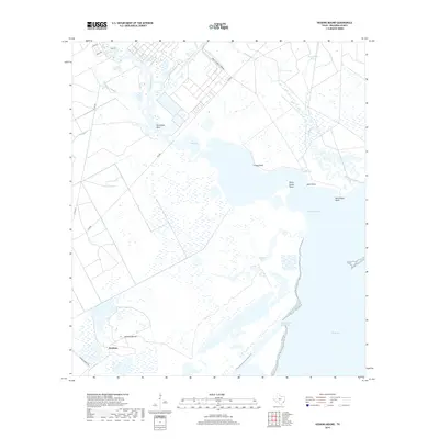
2019 Map of Hoskins Mound
USGS Topo · Published 2019About this map
Hoskins and the distinctive geological feature of Hoskins Mound anchor this coastal landscape where the Texas prairie meets the Gulf's complex aquatic margins. The geography is defined by a dense network of tidal channels including Chocolate Bayou, Berry Bayou, and New Bayou, which drain into the broad expanse of Chocolate Bay and West Bay. Human industry is clearly marked by the Intracoastal Waterway cutting through the marshlands and the industrial footprint of the Amoco Chemical Company near the bayou's edge. Navigational landmarks like Grassy Point, Horse Grove Point, and Shell Point trace the irregular shoreline, while the Humble Cut reflects local maritime engineering. This 2019 survey documents a landscape of salt marshes and managed waterways, illustrating how local roads like FM 2004 and Hoskins Mound Rd navigate the low-lying terrain between the bayous and the bay.
Find a feature on this map
26 named features on this map. Tap any name to fly to it.
Don’t see what you’re looking for? This feature index may not catch every label — zoom into the map to look around manually.
Map Details
Editions of this 2019 Hoskins Mound Map
This is the sole edition of this map. No revisions or reprints were ever made.
Other maps of this area

1929 · Karankawa Lake
USGS Topo · 1:24,000

1929 · Hitchcock
USGS Topo · 1:24,000

1932 · Hitchcock
USGS Topo · 1:31,680

1932 · Mustang Bayou
USGS Topo · 1:31,680

1933 · Karankawa Lake
USGS Topo · 1:31,680

1933 · San Luis Pass
USGS Topo · 1:31,680

1943 · San Luis Pass
USGS Topo · 1:31,680

1943 · Oyster Creek
USGS Topo · 1:31,680

1943 · Danbury
USGS Topo · 1:31,680

1943 · Mustang Bayou
USGS Topo · 1:31,680