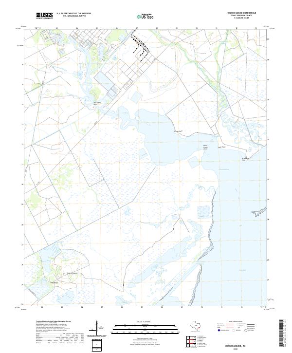
2022 Map of Hoskins Mound
USGS Topo · Published 2022About this map
Hoskins Mound rises above the low coastal wetlands of Brazoria County, providing a distinct landmark in an area otherwise dominated by the sprawling tides of Chocolate Bay and West Bay. Near the settlement of Hoskins, the landscape is defined by the winding paths of Chocolate Bayou and Cottonwood Bayou, which carve through the salt marshes towards Lost Bay. This 2022 survey captures the transition from industrial utility to natural estuarine environments, where the Amoco Chemical Company facilities sit adjacent to the intricate drainage of Perry Bayou and Persimmon Bayou.
Find a feature on this map
26 named features on this map. Tap any name to fly to it.
Don’t see what you’re looking for? This feature index may not catch every label — zoom into the map to look around manually.
Map Details
Editions of this 2022 Hoskins Mound Map
This is the sole edition of this map. No revisions or reprints were ever made.
Other maps of this area

1929 · Karankawa Lake
USGS Topo · 1:24,000

1929 · Hitchcock
USGS Topo · 1:24,000

1932 · Hitchcock
USGS Topo · 1:31,680

1932 · Mustang Bayou
USGS Topo · 1:31,680

1933 · Karankawa Lake
USGS Topo · 1:31,680

1933 · San Luis Pass
USGS Topo · 1:31,680

1943 · San Luis Pass
USGS Topo · 1:31,680

1943 · Oyster Creek
USGS Topo · 1:31,680

1943 · Danbury
USGS Topo · 1:31,680

1943 · Mustang Bayou
USGS Topo · 1:31,680