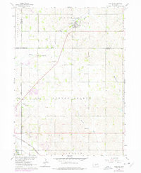
1963 Map of Hoskins
USGS Topo · Published 1977About this map
The village of Hoskins serves as the focal point of this northeast Nebraska quadrangle, situated at the junction of Wayne, Pierce, Stanton, and Madison counties. The landscape is defined by the South Branch Spring Branch and Maskenthine Creek, while the Chicago and North Western railroad cuts across the southwestern corner. Cultural and genealogical sites are prominent, including several religious landmarks such as Trinity Ch and Peace Ch, alongside the Lutheran Cem, Zion Cem, and the notable State Hospital Cem. An Old Railroad Grade north of Warnerville reveals earlier transportation corridors that once stitched these farming communities together. The map also documents rural education through School No 26 and School No 10, illustrating the distributed nature of the plains settlement pattern during the mid-20th century.
Find a feature on this map
31 named features on this map. Tap any name to fly to it.
Don’t see what you’re looking for? This feature index may not catch every label — zoom into the map to look around manually.
Map Details
Editions of this 1963 Hoskins Map
2 editions found
Other maps of this area

1955 · Sioux City
USGS Topo · 1:250,000

1955 · Fremont
USGS Topo · 1:250,000

1957 · Fremont
USGS Topo · 1:250,000

1958 · Sioux City
USGS Topo · 1:250,000

1958 · Fremont
USGS Topo · 1:250,000

1959 · Sioux City
USGS Topo · 1:250,000

1963 · Hoskins
USGS Topo · 1:24,000

1963 · Wayne SW
USGS Topo · 1:24,000

1963 · Norfolk
USGS Topo · 1:24,000

1963 · Winside
USGS Topo · 1:24,000