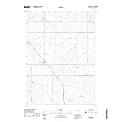
2017 Map of Hot Springs SE
USGS Topo · Published 2017About this map
The Cheyenne River winds through the northern reaches of this Fall River County landscape, set against a backdrop of deep drainage channels like Horse Camp Draw and Slate Spring Draw. This 2017 survey captures a largely rural area defined by its water resources and sparse road network, most notably where the Angostura Reservoir sits at the western edge. For genealogists and local historians, several small burial grounds are documented across the townships, providing specific points of interest for family research.
Find a feature on this map
36 named features on this map. Tap any name to fly to it.
Don’t see what you’re looking for? This feature index may not catch every label — zoom into the map to look around manually.
Map Details
Editions of this 2017 Hot Springs SE Map
This is the sole edition of this map. No revisions or reprints were ever made.
Other maps of this area

1896 · Oelrichs
USGS Topo · 1:125,000

1900 · Oelrichs
USGS Topo · 1:125,000

1950 · Hot Springs
USGS Topo · 1:24,000

1950 · Buffalo Gap
USGS Topo · 1:24,000

1950 · Hot Springs SE
USGS Topo · 1:24,000

1950 · Angostura Reservoir
USGS Topo · 1:24,000

1951 · Smithwick NW
USGS Topo · 1:24,000

1955 · Hot Springs
USGS Topo · 1:250,000
1982 · Smithwick
USGS Topo · 1:25,000
1982 · Lone Well Creek East
USGS Topo · 1:24,000