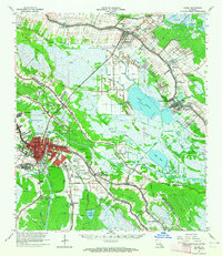
1963 Map of Houma
USGS Topo · Published 1964About this map
The low-lying wetlands of southern Louisiana are defined by a complex web of waterways and industrial infrastructure in the early 1960s. Bayou Lafourche and the Gulf Intracoastal Waterway serve as the primary conduits for transportation and commerce, connecting major settlements like Houma, Raceland, and Lockport. The landscape is heavily marked by the region's energy economy, featuring the Lafourche Crossing Oil and Gas Field and the Raceland Oil and Gas Field, alongside numerous pumping stations and filtration plants required for life on the delta.
Find a feature on this map
101 named features on this map. Tap any name to fly to it.
Don’t see what you’re looking for? This feature index may not catch every label — zoom into the map to look around manually.
Map Details
Editions of this 1963 Houma Map
4 editions found
Other maps of this area

1891 · Hahnville
USGS Topo · 1:62,500

1892 · Lac Des Allemands
USGS Topo · 1:62,500

1892 · Gibson
USGS Topo · 1:62,500

1892 · Cut-Off
USGS Topo · 1:62,500

1892 · Houma
USGS Topo · 1:62,500

1892 · Thibodaux
USGS Topo · 1:62,500

1894 · Bayou De Large
USGS Topo · 1:62,500

1894 · Lake Felicity
USGS Topo · 1:62,500

1894 · Dulac
USGS Topo · 1:62,500

1897 · Gibson
USGS Topo · 1:62,500