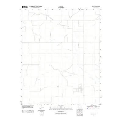
2010 Map of House
USGS Topo · Published 2010About this map
Alamosa Creek winds through this section of the High Plains, carving a shallow path across a landscape defined by an orderly grid of rural roads in Quay County. The settlement of House serves as the primary community hub, featuring the House Post Office and the nearby House Cemetery. This 2010 survey illustrates the sparse, ranching-oriented settlement patterns of eastern New Mexico, where small named locales like Upton and Bass represent historical gathering points along the extensive network of routes such as Quay Road BE and Quay Road BC. The map provides a detailed view of property access and rural infrastructure at the start of the 21st century, showing how the environment is managed through a system of numbered and lettered Quay Roads that facilitate travel across the wide, open terrain.
Find a feature on this map
29 named features on this map. Tap any name to fly to it.
Don’t see what you’re looking for? This feature index may not catch every label — zoom into the map to look around manually.
Map Details
Editions of this 2010 House Map
This is the sole edition of this map. No revisions or reprints were ever made.
Other maps of this area

1954 · Fort Sumner
USGS Topo · 1:250,000

1954 · Clovis
USGS Topo · 1:250,000

1958 · Fort Sumner
USGS Topo · 1:250,000

1958 · Clovis
USGS Topo · 1:250,000

1968 · Hassell
USGS Topo · 1:24,000

1968 · Ima SE
USGS Topo · 1:24,000

1968 · Candy Mesa
USGS Topo · 1:24,000

1970 · Jordan
USGS Topo · 1:24,000
1970 · Cunavea Basin
USGS Topo · 1:24,000

1973 · House
USGS Topo · 1:24,000