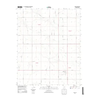
2013 Map of House
USGS Topo · Published 2013About this map
House stands as the primary settlement on this eastern New Mexico plateau, established at the junction of Nm-252 and Main St. The town's layout is defined by a grid of local thoroughfares including 6th St and S Ash St, with a Po serving the local community. To the northwest, the House Cem provides a genealogical touchstone for the area. The surrounding landscape is characterized by the winding path of Alamosa Cr, which cuts across the terrain near the small localities of Upton and Bass. A systematic network of county roads, such as Quay Road AZ and Quay Road 29, organizes the agricultural and ranching lands of the High Plains. This 2013 survey illustrates a rural infrastructure built around section lines and seasonal drainage patterns, reflecting the enduring spatial organization of Quay County.
Find a feature on this map
39 named features on this map. Tap any name to fly to it.
Don’t see what you’re looking for? This feature index may not catch every label — zoom into the map to look around manually.
Map Details
Editions of this 2013 House Map
This is the sole edition of this map. No revisions or reprints were ever made.
Other maps of this area

1954 · Fort Sumner
USGS Topo · 1:250,000

1954 · Clovis
USGS Topo · 1:250,000

1958 · Fort Sumner
USGS Topo · 1:250,000

1958 · Clovis
USGS Topo · 1:250,000

1968 · Hassell
USGS Topo · 1:24,000

1968 · Ima SE
USGS Topo · 1:24,000

1968 · Candy Mesa
USGS Topo · 1:24,000

1970 · Jordan
USGS Topo · 1:24,000
1970 · Cunavea Basin
USGS Topo · 1:24,000

1973 · House
USGS Topo · 1:24,000