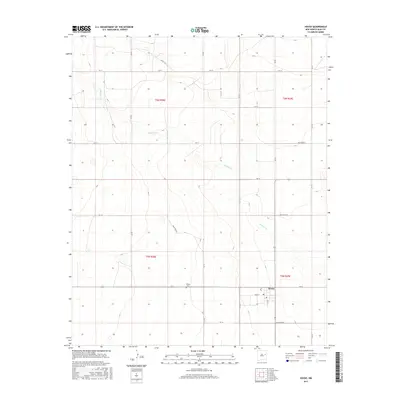
2017 Map of House
USGS Topo · Published 2017About this map
House stands as a focal point in this high plains landscape of Quay County, centered around the intersection of Main St and S Ash St. The village is anchored by local infrastructure, including a Po and the nearby House Cem situated just to the west. The terrain is defined by the winding course of Alamosa Cr, which cuts through the township sections of t6n r28e and t5n r29e. A structured grid of secondary routes, such as Quay Road 31 and Quay Road 26, provides a clear view of the rural land divisions and property access points during the mid-2010s. This survey illustrates the persistent importance of small agricultural hubs and their connection to the intermittent water sources of the New Mexico mesa country.
Find a feature on this map
22 named features on this map. Tap any name to fly to it.
Don’t see what you’re looking for? This feature index may not catch every label — zoom into the map to look around manually.
Map Details
Editions of this 2017 House Map
This is the sole edition of this map. No revisions or reprints were ever made.
Other maps of this area

1954 · Fort Sumner
USGS Topo · 1:250,000

1954 · Clovis
USGS Topo · 1:250,000

1958 · Fort Sumner
USGS Topo · 1:250,000

1958 · Clovis
USGS Topo · 1:250,000

1968 · Hassell
USGS Topo · 1:24,000

1968 · Ima SE
USGS Topo · 1:24,000

1968 · Candy Mesa
USGS Topo · 1:24,000

1970 · Jordan
USGS Topo · 1:24,000
1970 · Cunavea Basin
USGS Topo · 1:24,000

1973 · House
USGS Topo · 1:24,000