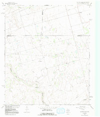
1966 Map of Houston Ranch
USGS Topo · Published 1968About this map
Houston Ranch and the nearby Old Houston Place anchor this 1966 West Texas survey at the junction of Glasscock, Howard, and Martin counties. The landscape is defined by the ephemeral courses of Hamilton Draw and Mustang Draw, which cut through a terrain dotted with early energy and ranching infrastructure. Isolated outposts like Stone Ranch, Cross Ranch, and the settlement of Lomax reveal the sparse but organized occupation of the Llano Estacado. The economy of the era is clearly visible through a dense network of pipelines, an established Landing Strip, and numerous industrial sites including Pepper Well, South Well, and various gravel pits. To the southeast, Hog Mountain provides a rare topographic break in the wide plains, while the proliferation of oil wells across the northwest indicates the steady expansion of the Permian Basin's oil fields during the mid-1960s.
Find a feature on this map
19 named features on this map. Tap any name to fly to it.
Don’t see what you’re looking for? This feature index may not catch every label — zoom into the map to look around manually.
Map Details
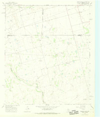
Editions of this 1966 Houston Ranch Map
2 editions found
Other maps of this area

1941 · Morita
USGS Topo · 1:62,500

1949 · Morita
USGS Topo · 1:62,500

1954 · Big Spring
USGS Topo · 1:250,000

1954 · San Angelo
USGS Topo · 1:250,000

1958 · San Angelo
USGS Topo · 1:250,000

1958 · Big Spring
USGS Topo · 1:250,000

1964 · Dewey Lake NE
USGS Topo · 1:24,000

1965 · San Angelo
USGS Topo · 1:250,000

1965 · Dewey Lake
USGS Topo · 1:24,000

1965 · Spraberry
USGS Topo · 1:24,000