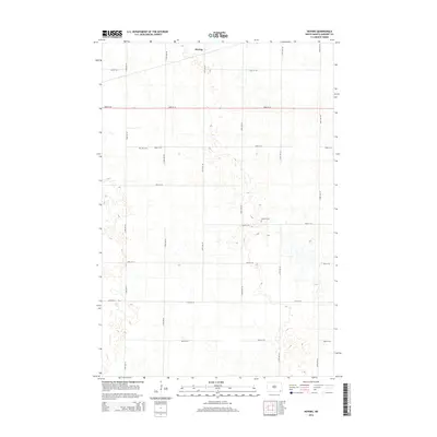
2014 Map of Hoving
USGS Topo · Published 2014About this map
The settlement of Hoving and the surrounding prairie landscape of Sargent County are defined by a rhythmic grid of section-line roads in this modern topographic study. This agricultural expanse is dotted with numerous small wetlands and prairie potholes, typical of the regional topography. Local heritage is preserved at two distinct burial sites: Zion Cem in the northwest and Dunbar Cem situated further east along 85th St SE. The map illustrates the persistent structure of rural North Dakota, where the transport network of numbered avenues and streets, such as 133rd Ave SE and 82nd St SE, dictates the placement of homesteads and farms. This layout reflects the enduring impact of the Public Land Survey System on the development of the Great Plains.
Find a feature on this map
17 named features on this map. Tap any name to fly to it.
Don’t see what you’re looking for? This feature index may not catch every label — zoom into the map to look around manually.
Map Details
Editions of this 2014 Hoving Map
This is the sole edition of this map. No revisions or reprints were ever made.
Other maps of this area

1907 · Wyndmere
USGS Topo · 1:125,000

1953 · Fargo
USGS Topo · 1:250,000

1956 · Fargo
USGS Topo · 1:250,000

1958 · Rutland
USGS Topo · 1:24,000
1958 · Forman
USGS Topo · 1:24,000

1958 · Cayuga NW
USGS Topo · 1:24,000
1958 · Cayuga
USGS Topo · 1:24,000

1960 · Lisbon SE
USGS Topo · 1:24,000

1960 · Milnor
USGS Topo · 1:24,000
1962 · Hoving
USGS Topo · 1:24,000